Fig. 1.
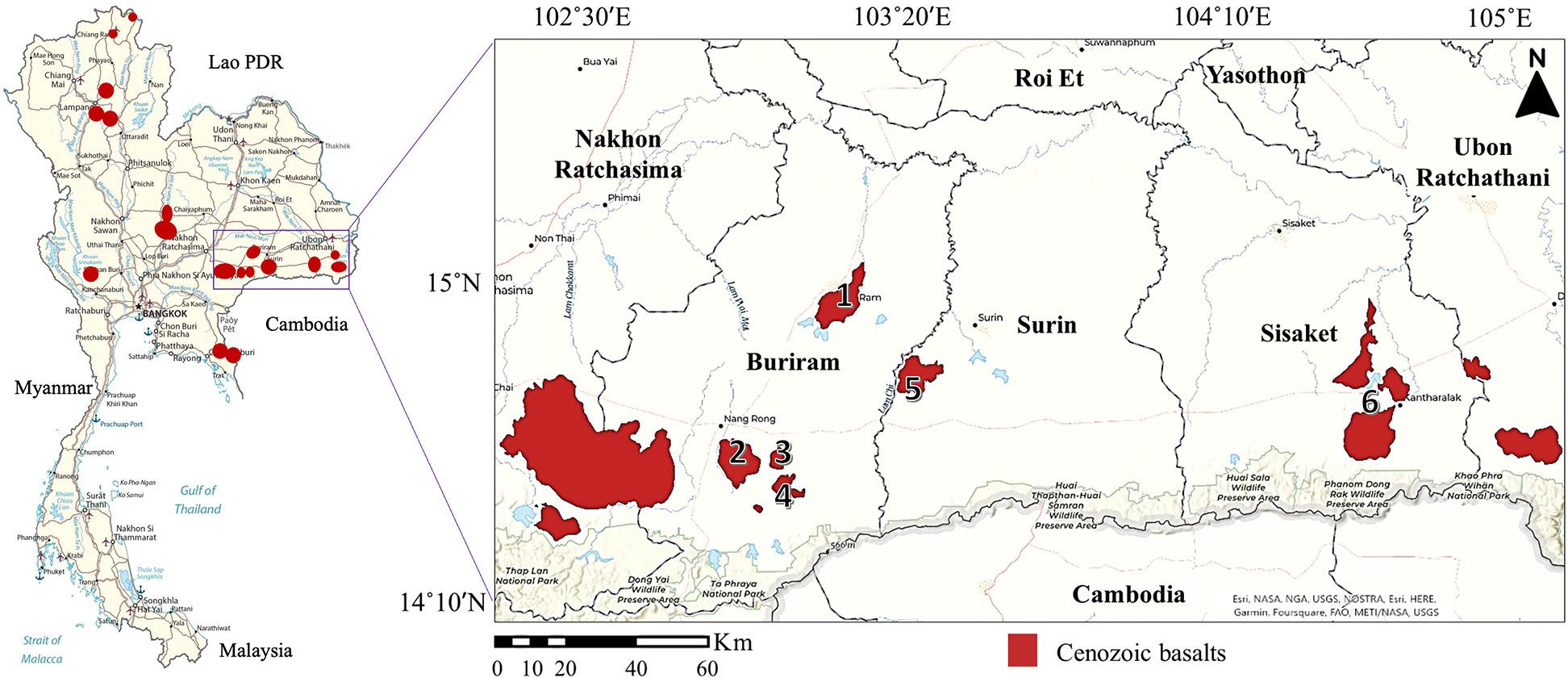
Fig. 2.
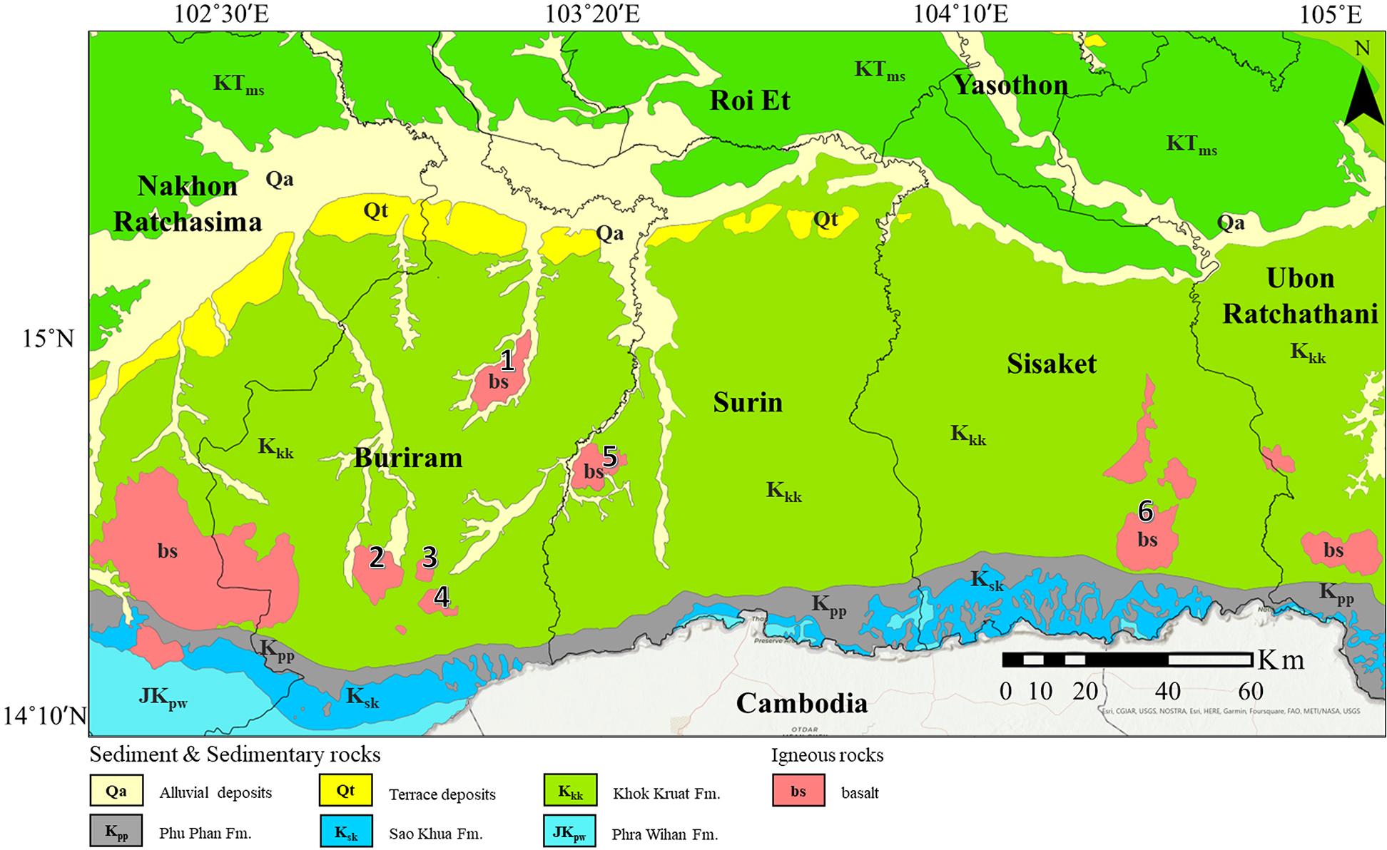
Fig. 3.
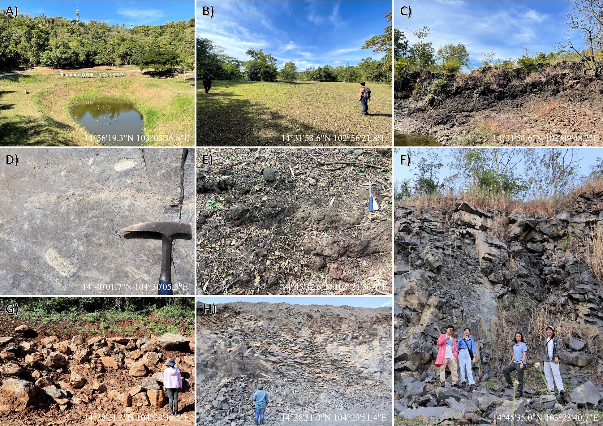
Fig. 4.
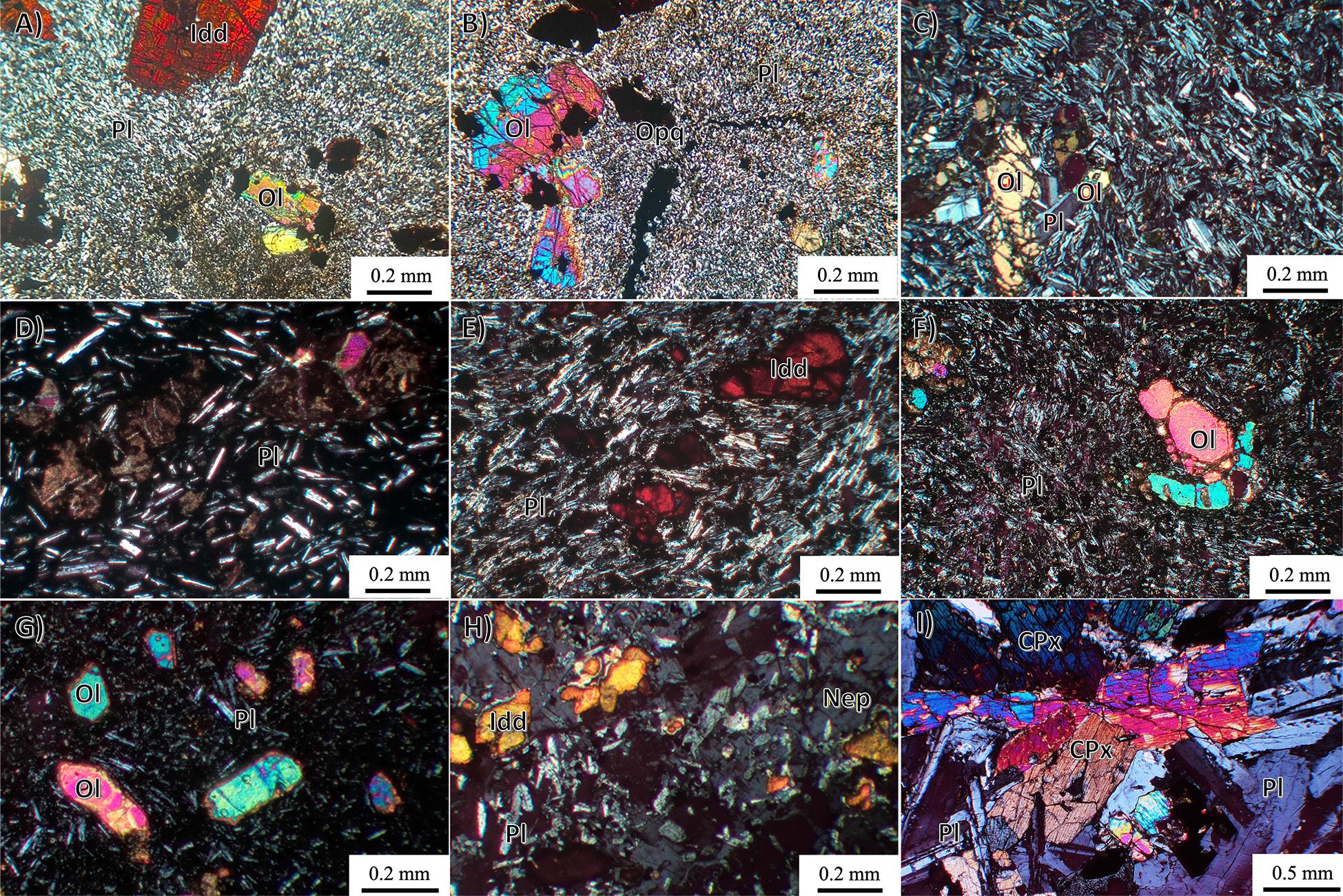
Fig. 5.
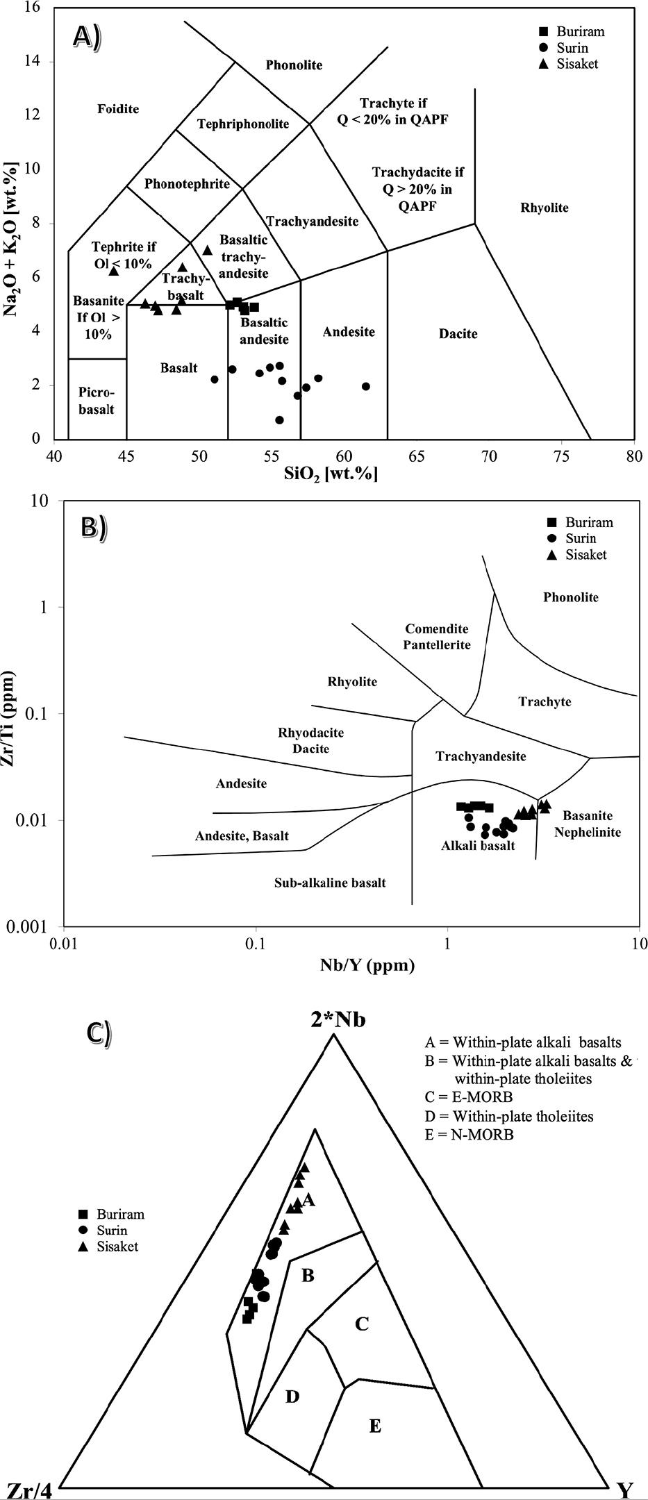
Fig. 6.
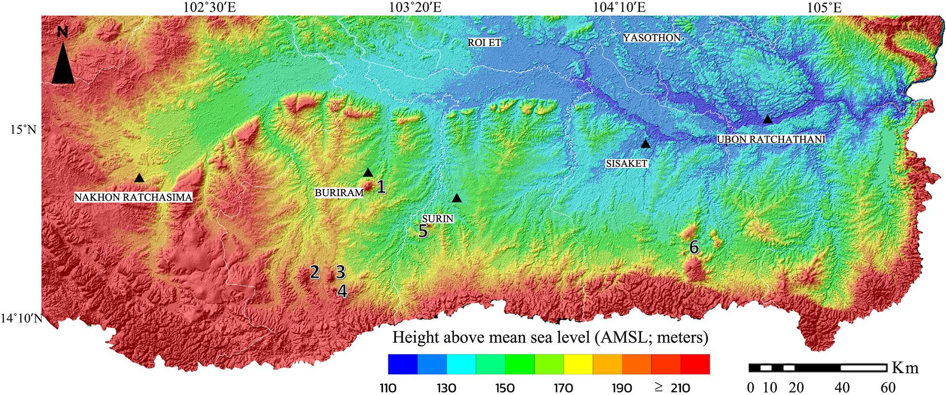
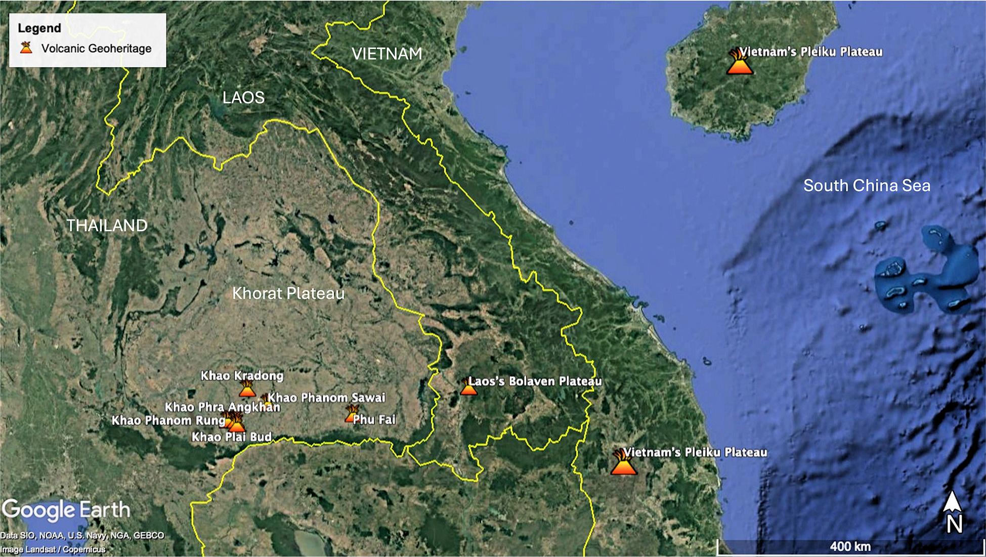
Fig. 7.
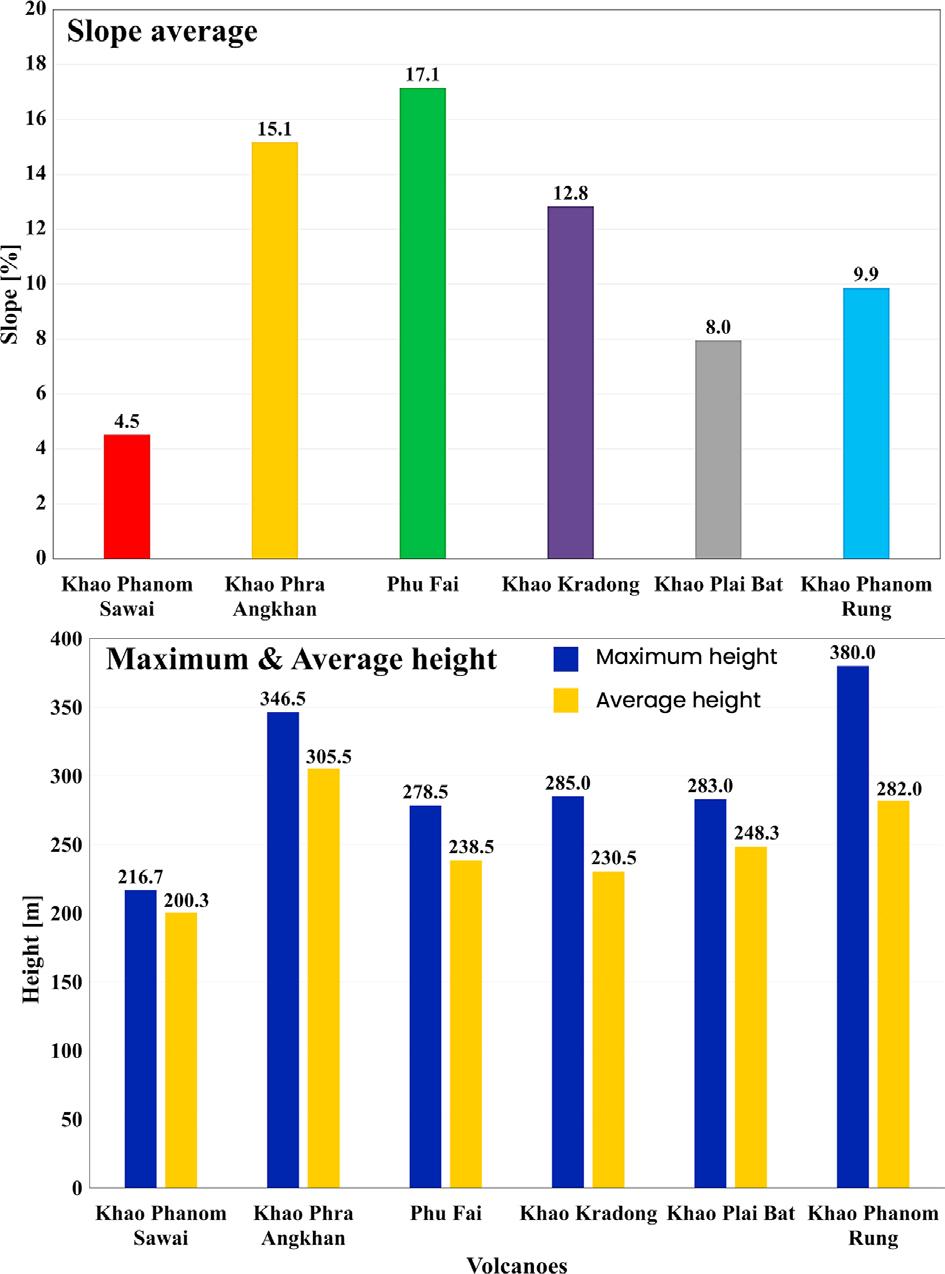
Fig. 8.
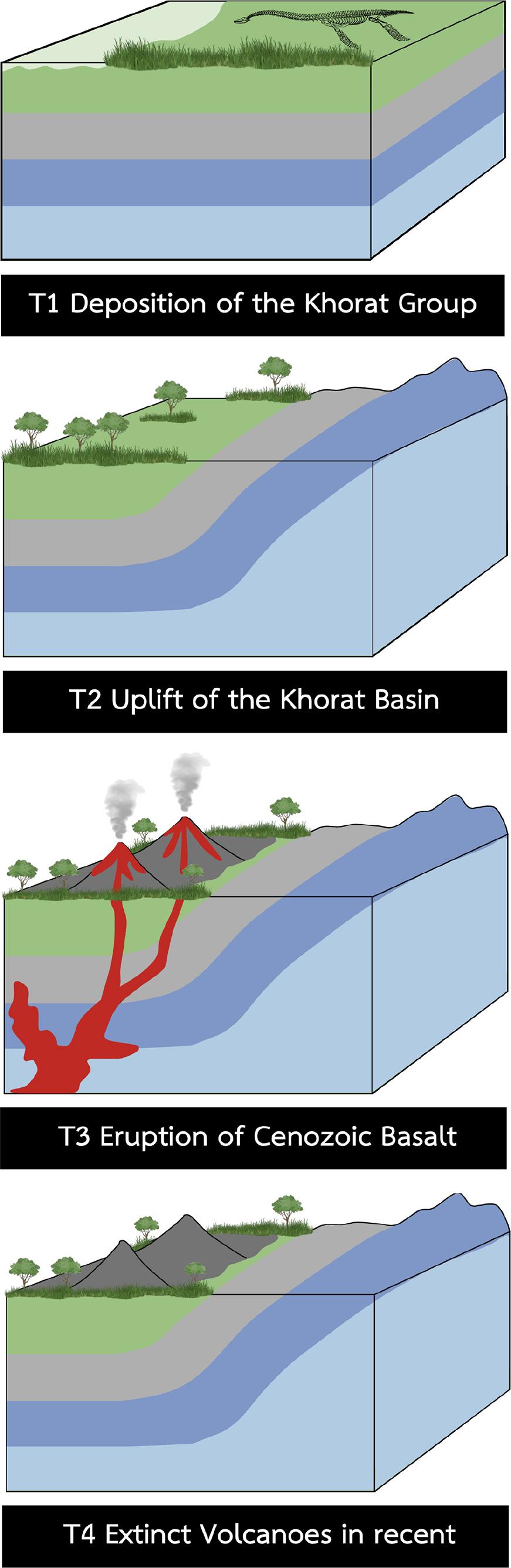
Fig. 9.
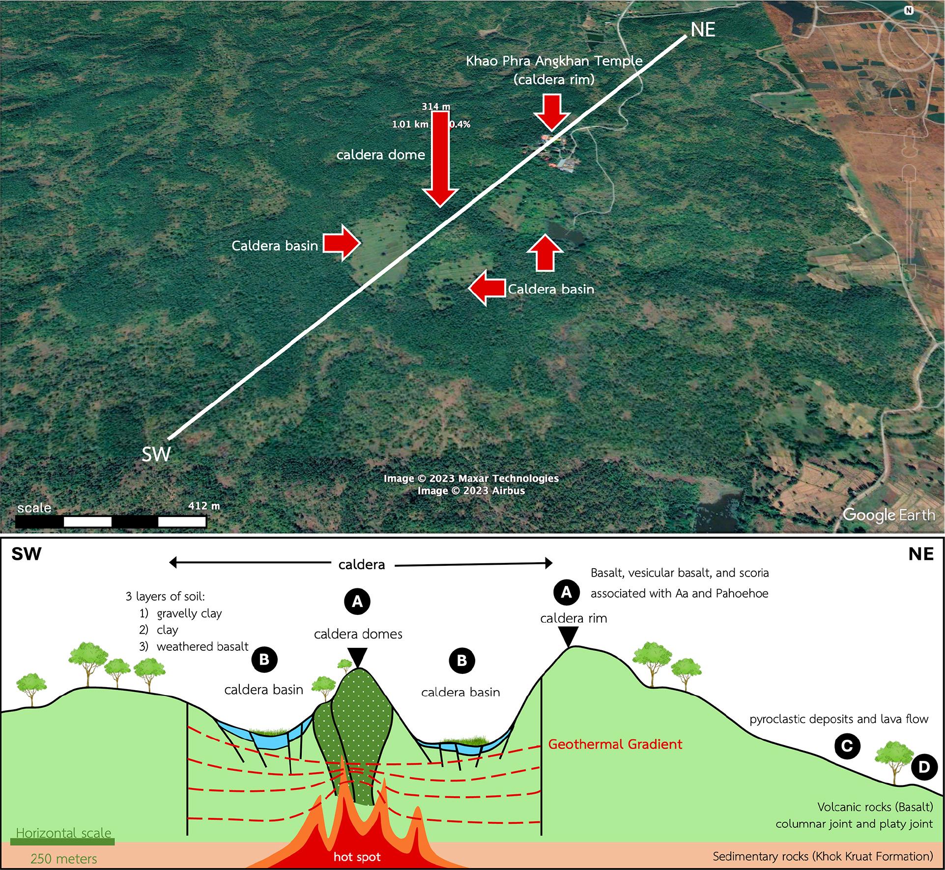
Fig. 10.
Geomorphological and geochemical data of volcanoes in the southern part of the Khorat Plateau_
| Group | Volcano name | Average slope | SiO2 | Al2O3 | Fe2O3 | MgO | CaO | LOI* |
|---|---|---|---|---|---|---|---|---|
| [%] | [wt.%] | |||||||
| 1 | Khao Phanom Sawai | 4.52 | 51.07 | 14.57 | 14.60 | 2.69 | 8.62 | 1.25 |
| Khao Kradong | 6.10 | 48.55 | 14.36 | 10.81 | 6.00 | 9.28 | 1.25 | |
| 2 | Khao Plai Bat | 7.95 | 52.04 | 14.91 | 10.93 | 5.50 | 6.98 | 0.34 |
| Khao Phanom Rung | 9.87 | 52.56 | 15.22 | 9.82 | 3.46 | 6.27 | 1.54 | |
| 3 | Khao Phra Angkhan | 15.00 | 55.96 | 19.55 | 12.05 | 1.30 | 4.63 | 0.78 |
| Phu Fai | 17.15 | 50.36 | 19.68 | 6.27 | 5.56 | 7.12 | 1.76 | |