
Table 1
Selected technical parameters of the measuring device.
| Parameter | Characteristic |
|---|---|
| weight | 380 g |
| dimension | 5,5 × 8,2 × 15,8 cm |
| standard of data transmission | LoRaWAN |
| frequency bands | 868 MHz |
| operating time [3 000 mAh] | ∼ 12 month |
| range in built-up areas | 3–4 km |
| number of measurements during the day | 36 |
| frequency of measurements | 15 min |
| operational time | 21:00–06:00 CEST |
| measuring sensors | surface brightness of the sky, temperature, humidity |
| the angle of data collection | 20° |
| tightness class | IP65 |
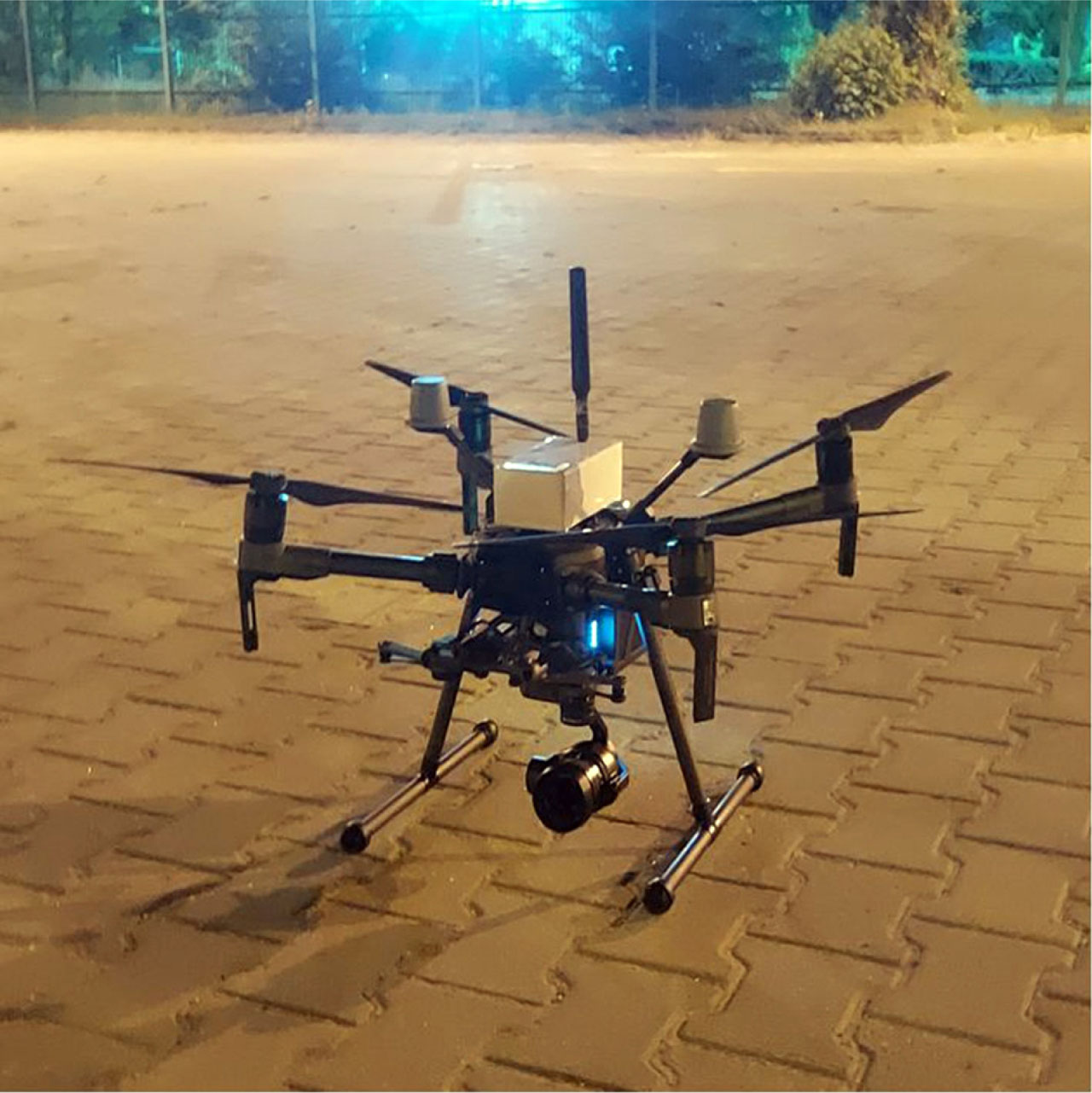
Fig. 1
DJI Matrice 210 RTK drone with its proprietary measuring device (photo D.Karpińska).
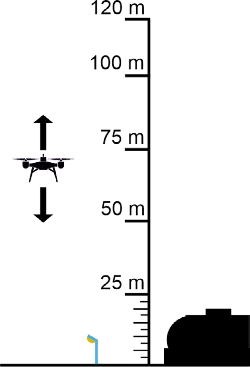
Fig. 2
Schematic representation of the altitudes selected for the acquisition of data on light pollution of the night sky.

Fig. 3
Daytime (bottom) and nighttime (top) 360° panorama around the measurement location at the NCU campus (photo M.Kunz).

Fig. 4
Daytime (bottom) and nighttime (top) 360° panorama around the measurement location at the car park at Bema Street (photo D.Karpińska).
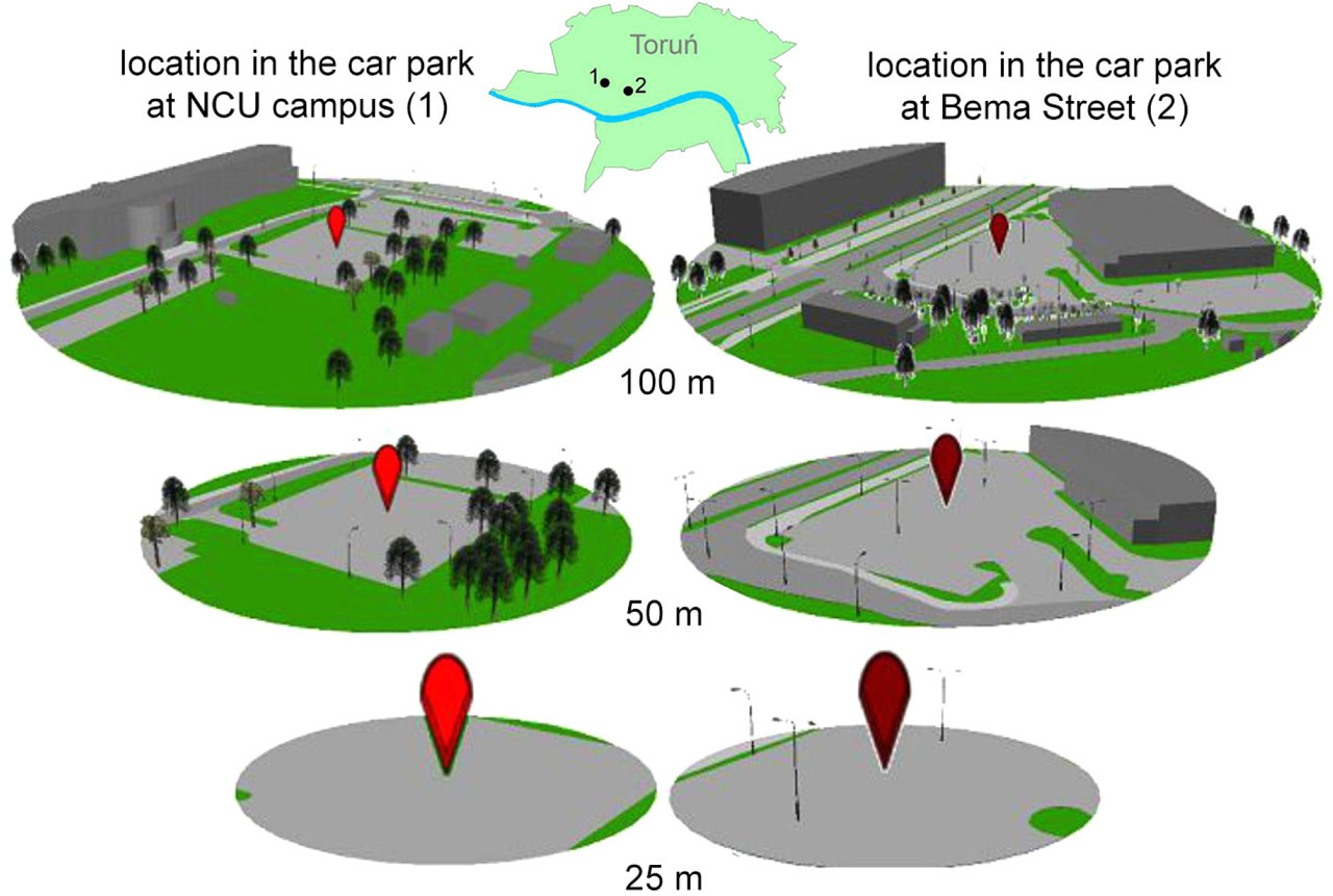
Fig. 5
Visualisation of land cover/land use at measurement locations in three buffer zones (25 m, 50 m and 100 m).
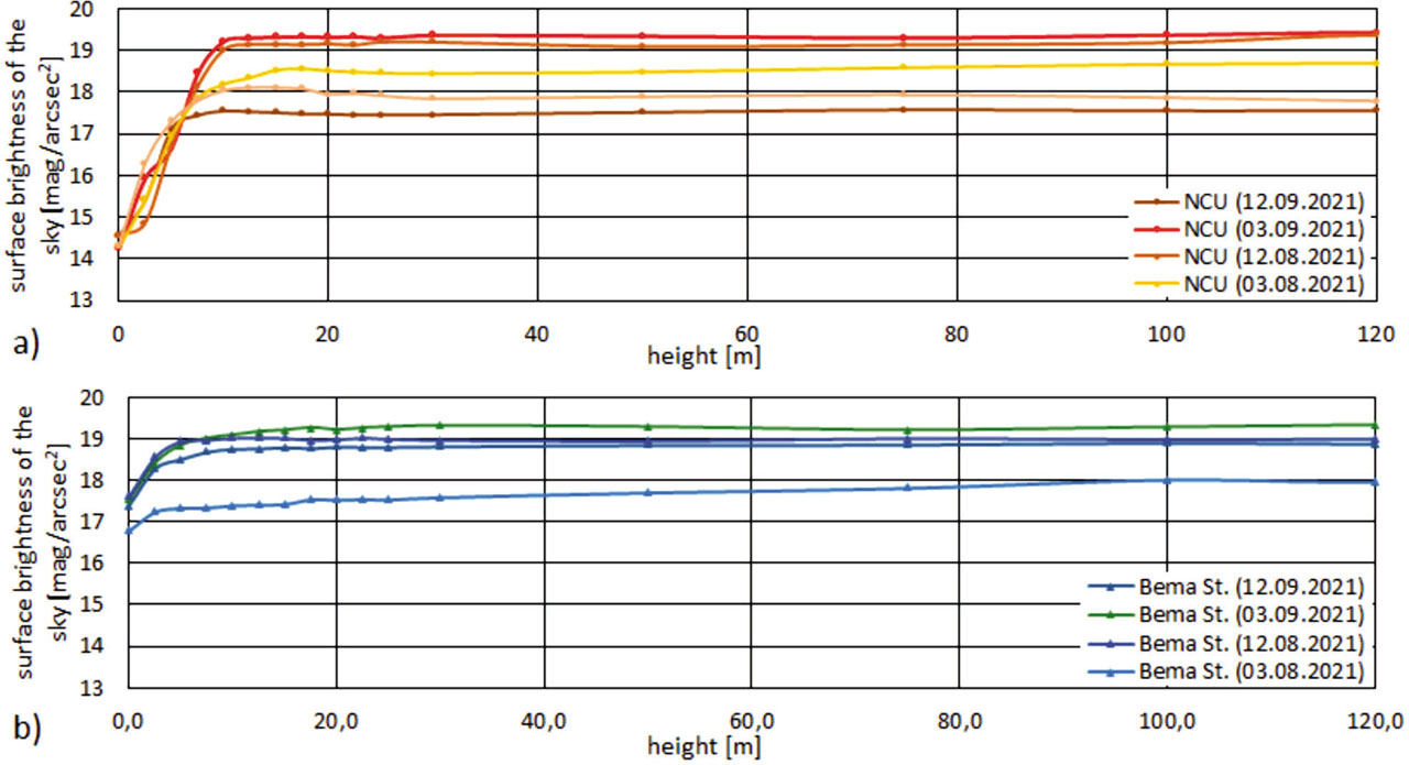
Fig. 6
Summary of the obtained results illustrating the variability of the night sky brightness in the vertical gradient at the measuring site located in Toruń: (a) at the NCU car park, (b) at the car park in Bema Street.
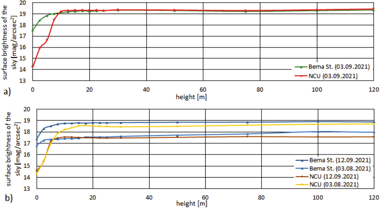
Fig. 7
Comparison of the obtained results showing variability of the night sky brightness in the vertical gradient at both measurement locations during: (a) cloudless night, (b) night with varied cloud cover.